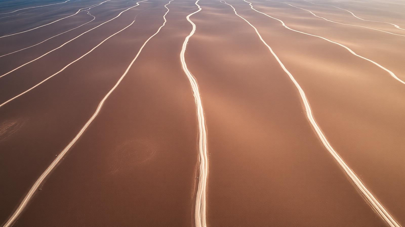
Aerial view of geometric lines and a figurative geoglyph on the Nazca desert plateau
Evidence File 05Archaeological Evidence

Nazca Lines

Nazca Desert, Peru · c. 500 BCE – 500 CE

What were geoglyphs meant to do for people who could not see them from above?

Chicago style · PDF or .txt

The Nazca geoglyphs are frequently described as impossible to make without flight. They are not. Removing dark oxidised stones to expose pale ground beneath requires string, stakes, and patience — all of which have been demonstrated experimentally.

The Nazca pampa. The construction method is well understood; the purpose is not.

Historical record

No Nazca writing survives; associated pottery and posts provide dating.

Current scientific consensus

Ritual pathways connected to water, fertility and processional practice.

How they were made

The pampa is covered by a layer of iron-oxide-darkened pebbles over lighter sediment. Clearing the pebbles into low berms produces a durable pale line in one of the driest, least windy environments on Earth. Experimental archaeology has reproduced large figures using only survey stakes, cord, and small teams working from scaled ground plans. Wooden stakes recovered at line termini have been radiocarbon dated.
Purpose: several answers, unevenly supported

Water is the strongest thread. Many lines relate spatially to the puquios — subterranean aqueducts — and to fault-fed groundwater routes in a region where water access is existential. Ceremonial procession is supported by the ceramics trampled along certain lines and by the fact that many figures are drawn as a single unbroken path, walkable end to end.

The astronomical-calendar hypothesis has been tested statistically against the line azimuths more than once and has not held up: the alignments are not better than chance for a set of that size. It survives in popular accounts anyway.

Recent AI-assisted aerial survey has multiplied the known figure count substantially, which changes the statistics of any purpose argument and is still being absorbed by the field.

What we refuse to print as equivalent

Runway and landing-site claims are not a competing hypothesis. They require ignoring the soft, shallow substrate the lines are cut into — which would not survive a landing — and the dated Nazca-culture material found along them.

Competing interpretations

An astronomical calendar.

Active Academic Debate
48% support

Specialists disagree. Competing interpretations are presented side by side.

Water-source markers across the desert.

Active Academic Debate
48% support

Specialists disagree. Competing interpretations are presented side by side.

Signals intended for aerial observers.

Speculative Theory
10% support

Proposed but unsupported by accepted evidence. Reported, never endorsed.

Support scores reflect the strength of the evidence class behind a claim, not how often you have heard it. Speculative entries appear because readers encounter them — never because we endorse them.

The dossier
Chicago style · PDF or .txt
The evidence base

Surface geoglyphs on a desert pampa, associated ceramics and posts, and expanding aerial and machine-learning survey.

How it is dated

Each row states the method, what was measured, and — the part usually skipped — what the result does not settle.

MethodSampleResultWhat it constrains
Associated ceramicsSherds recovered on and beside line surfacesPredominantly Nasca-period, with earlier Paracas-period figuresDates activity near the lines rather than the act of clearing them.
RadiocarbonWooden posts at line terminalsConsistent with the ceramic rangeGives anchor points for a few features, not for the whole field.
Aerial and AI-assisted surveyHigh-resolution imagery of the pampaHundreds of additional figures identified in recent seasonsExpands the corpus; new figures still require ground validation.
Competing readings, scored

The percentage is our editorial reading of how much of the surviving record each claim accounts for. It is a judgement, stated openly, not a consensus figure.

  • Ritual pathways connected with water, fertility and procession.

    Open Debate
    Explains the record70%
    Rests on
    • Lines converge on water-related features and ceremonial locations.
    • Many are walkable single-line paths, consistent with procession.
    Runs into
    • Ritual is a broad label that absorbs several distinct behaviours.
  • A large-scale astronomical calendar.

    Speculative
    Explains the record22%
    Rests on
    • A subset of lines align with solstitial and stellar events.
    Runs into
    • Statistical tests find alignment rates close to what random orientation would produce.
  • Markings intended to be seen from the air by non-human visitors.

    Speculative
    Explains the record2%
    Rests on
    • Rests entirely on the figures being legible from altitude.
    Runs into
    • The figures are legible from surrounding foothills.
    • Construction method is documented and requires no aerial view.
Where to check us
  • Nasca geoglyph survey publications

    PNAS / Journal of Archaeological Science

  • Site management and inventory records

    Peruvian Ministry of Culture / UNESCO

What would change this
  • Systematic dating of the clearing surfaces themselves rather than of nearby material.

What the record supports

  • Walked-path wear analysis
  • Ceramic sherd scatters along lines
  • AI-assisted discovery of new figures

What remains open

  • How many geoglyphs remain undetected?
  • Were figures made for single-use ceremonies?
How this file was built

Construction claims are grounded in experimental replication and dated stake material. Purpose claims are ranked by whether they have been tested against the full line inventory rather than a selected subset.

What would settle it
  • Systematic dating across the newly surveyed figures
  • Published spatial statistics linking line networks to mapped puquio and aquifer routes
  • Excavation of terminal structures at a representative sample of lines