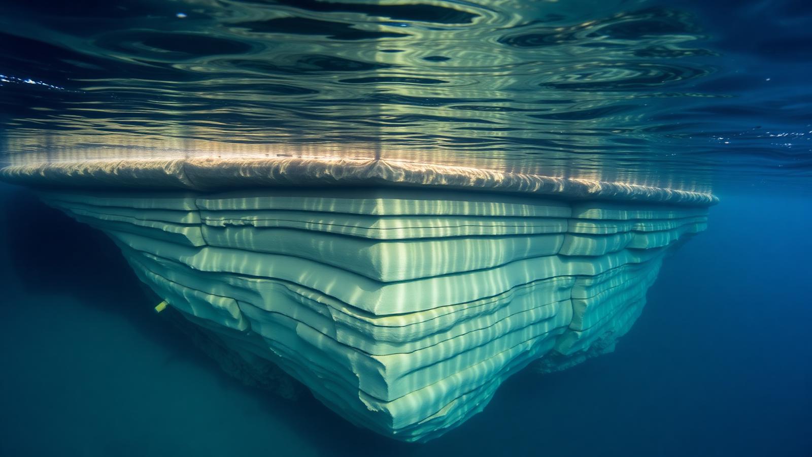
Submerged sandstone formation with flat terraces and straight fracture lines in clear blue water
Evidence File 13Active Academic Debate

Yonaguni Monument

Okinawa, Japan · Disputed

Is the Yonaguni formation carved, natural, or natural rock modified by people?

Chicago style · PDF or .txt

Off the coast of Yonaguni sits a large submerged sandstone formation with flat terraces, straight edges and step-like faces. Whether a human hand shaped any of it is the whole question, and the geology has the stronger case.

Yonaguni. Sandstone bedding planes fracture at right angles — which is why this argument exists at all.

Historical record

No documentary record. Known only since a 1986 dive survey.

Current scientific consensus

Most geologists read it as natural sandstone fracturing along bedding planes.

The natural explanation

The formation is bedded sandstone and mudstone in a tectonically active zone. That lithology fractures along parallel bedding planes and near-perpendicular joint sets, producing flat surfaces and right angles without assistance. Comparable stepped formations occur above water on Yonaguni and neighbouring islands, where nobody proposes a builder.

The structure is also continuous with the surrounding bedrock. Cut-stone architecture generally is not: it consists of separated, moved units. Here there are no detached blocks, no quarry debris, no mortar, no fill.

The case for modification

A minority position, associated primarily with a Japanese marine geologist who has dived the site extensively, identifies features it argues are anthropogenic: paired holes, a supposed carved face, channels that appear to drain rather than accumulate. These have not been demonstrated to exceed what jointing and bioerosion produce, and no artefacts, tools, or occupation material have been recovered from the site.

The dating constraint

For the formation to have been worked while dry it would need to date to the last glacial low stand, roughly ten thousand years ago or more. That is not impossible for the region — Jōmon-era populations were present in the archipelago — but it would require a monumental stone tradition for which the terrestrial record on those islands provides no support.

Competing interpretations

A wholly natural formation.

Scientific Consensus
80% support

The mainstream position across the relevant scientific literature today.

A natural formation with human modification.

Active Academic Debate
48% support

Specialists disagree. Competing interpretations are presented side by side.

A submerged Ice Age city.

Speculative Theory
10% support

Proposed but unsupported by accepted evidence. Reported, never endorsed.

Support scores reflect the strength of the evidence class behind a claim, not how often you have heard it. Speculative entries appear because readers encounter them — never because we endorse them.

The dossier
Chicago style · PDF or .txt
The evidence base

A submerged sandstone formation off Yonaguni Island, its bedding planes and fracture patterns, and the regional sea-level record.

How it is dated

Each row states the method, what was measured, and — the part usually skipped — what the result does not settle.

MethodSampleResultWhat it constrains
Sea-level reconstructionRegional postglacial sea-level curvesThe structure was above water before the early HoloceneEstablishes when the surface was exposed. It does not establish that anyone shaped it.
Structural geologyBedding, jointing and fracture orientation in the sandstoneSteps and terraces align with natural bedding and joint setsShows the geometry is what this rock type produces when it fractures.
Survey for cultural materialThe formation and its surroundingsNo tools, spoil, inscriptions or artefacts recovered from the structureAbsence of the debris a quarry or construction site normally leaves.
Competing readings, scored

The percentage is our editorial reading of how much of the surviving record each claim accounts for. It is a judgement, stated openly, not a consensus figure.

  • A natural sandstone formation shaped by bedding and wave erosion.

    Consensus
    Explains the record82%
    Rests on
    • The angular geometry matches the rock's joint structure.
    • Comparable formations occur above water elsewhere on the coast.
    Runs into
    • Certain features look strikingly regular to the eye.
  • A natural formation modified by people while it was above sea level.

    Open Debate
    Explains the record22%
    Rests on
    • The region was inhabited before inundation.
    • Partial modification would leave a subtle signature.
    Runs into
    • No tool marks or associated cultural deposits have been recovered.
  • A lost civilisation's built monument, submerged at the end of the ice age.

    Speculative
    Explains the record6%
    Rests on
    • The submersion timing is real and does overlap human presence.
    Runs into
    • Monumental construction leaves quarries, waste and settlement. None is present.
Where to check us
  • Yonaguni formation geological assessments

    Japanese geoscience literature / university survey reports

  • Ryukyu sea-level and coastal geomorphology studies

    Quaternary International

What would change this
  • Recovered tool marks, quarry debris or cultural deposits directly associated with the structure.

What the record supports

  • Regional bedding-plane geology
  • Absence of associated artifacts
  • Sea-level curves for the region

What remains open

  • Are there any worked tool marks?
  • Could shallower nearby sites hold artifacts?
How this file was built

Compared against dated subaerial formations of the same lithology. Anthropogenic claims are held to the standard of associated material culture, not visual resemblance.

What would settle it
  • Recovery of artefacts or tool marks in secure association with the formation
  • Petrological analysis distinguishing worked from jointed surfaces
  • Evidence of monumental stone construction in the contemporaneous island record